Protecting Wilderness Quality Land – and Having a Great Time – in Southeastern Utah (updated June 3)

By Gloria Gardiner, OFWU Steering Committee (all photos by the author)

For many years, I have hiked and photographed public lands in Utah and participated in land stewardship projects in the Pacific Northwest. On Saturday and Sunday, May 4-5 of this year, I participated in a SUWA stewardship weekend in southeastern Utah.

Of the nine volunteers, most were from Utah. One was from the Denver area, and I came from Portland. Our project leader was from SUWA, and a BLM backcountry ranger selected the projects and worked with us all weekend. The overall objectives were (a) to delineate the boundaries of BLM’s Coal Canyon Wilderness Study Area (WSA), and (b) to discourage illegal motor vehicle use inside the WSA. The work sites were about an hour east of Moab, Utah, and north of Interstate 70 in the Book Cliffs, the longest continuous rock escarpment in the world.

We began work on Saturday at a particular wash that comes out of a canyon in the WSA. It channels floodwaters, but it also attracts illegal off-highway vehicles (OHV) to travel into the WSA. On Saturday, with the BLM ranger’s direction, assistance, tools, and materials, we built a flood fence across the wash. This simple fence used wood posts, a steel cable connecting the posts, and wooden 2×4’s hanging from the cable but not touching the ground. The fence blocks most vehicular access while allowing flood waters to go down the wash. We finished this project in one day.

The ranger went back to Moab, and the rest of us set up a primitive camp for the night. I lay in my tent on my ancient Therma-Rest inflatable pad, covered by my down sleeping bag, and looked up at the cottonwood trees and desert sky. It was completely quiet. Our SUWA project leader provided dinner on Saturday night and coffee the next morning.

It took only part of Sunday to complete the other projects. First, we put wooden legs on a metal BLM sign and erected it at the WSA boundary.

Next, we disguised evidence of illegal motor vehicle usage in several places. We used boulders, dead juniper limbs, and duff from under living juniper trees. We shoveled and raked dirt to remove tire tracks.

Then we went our separate ways.

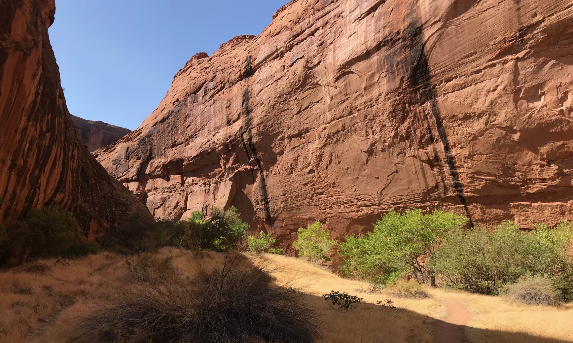
I stayed three more days in Moab to hike the East Rim and West Rim loop in Dead Horse Point State Park and the Murphy Trail in Canyonlands National Park’s Island in the Sky unit. I also drove the scenic La Sal Mountain Loop Road. Driving south of Moab in a counter-clockwise direction, the road descends from the snow-capped La Sal Mountains into Castle Valley, with red rock formations that rival those in Arches National Park. A left turn onto Utah Route 128 follows the Colorado River canyon west back to Moab. Here are a few of my photographs.

Dead Horse Point State Park


Island in the Sky District, Canyonlands National Park


La Sal Mountains

Route 128, Colorado River


Castle Valley

How we in the Pacific Northwest can help protect Bears Ears (updated May 29)

Thanks to all who joined us on May 22 for an informative webinar discussing Bears Ears National Monument with Judi Brawer and Dr. Lauren Henson. Their combined slide deck is posted here.

If you missed the webinar or just would like to view it again, our friends at SUWA have made the video recording available here.

As a reminder, the Bureau of Land Management is accepting public comment on its draft Resource Management Plan for Bears Ears through June 11. Public comments can be submitted via this web site (choose Participate Now on the left taskbar).

_________________________________________________________________________________

Please hold the time at 6:00 p.m. PDT on Wednesday, May 22, for a special webinar to learn more about the newly restored Bears Ears National Monument in southeastern Utah and the status of the Bureau of Land Management’s draft resource management plan for these wild and sacred lands.

Wildlands attorney Judi Brawer of the Southern Utah Wilderness Alliance (SUWA) and Tribal ecologist Lauren Henson will join us to provide an in-depth overview of the planning process and the opportunity – now open through June 11 – for the public to provide public comment on this draft plan to the BLM. 

Under the Presidential proclamation restoring Bears Ears, five regional Tribes – the Hopi Tribe, the Navajo Nation, the Ute Mountain Ute Tribe, the Ute Indian Tribe of the Uintah and Ouray Reservation, and the Pueblo of Zuni – play a special role in the management of the monument. During this webinar, we will learn more about the perspectives of the Bears Ears Commission from Dr. Lauren Henson.

Lauren leads the Bears Ears Cultural Resources Subcommittee for Land Management and facilitates communication among Tribal departments, Traditional Practitioners, Cultural Advisors, and Leadership within and between Tribes involved in the co-management of Bears Ears National Monument. Lauren also works to provide opportunities for communities to re-connect with the land and organizes conservation programs for Elders and Youth at Bears Ears. As a wildlife biologist with experience weaving western science and Indigenous knowledge to inform land stewardship, Lauren is committed to collaborative management that recognizes, respects, and advances Traditional knowledge.

Please join us Wednesday, May 22 for an interesting and timely discussion. Advance registration is requested.

This event is co-sponsored by Oregonians for Wild Utah and Washington Friends of Wild Utah.

Wednesday, May 22, 2024, 6:00 p.m. PDT

Click here to register for this Zoom webinar

[This post has been updated to reflect Dr. Lauren Henson’s participation in the webinar.]

Photography credits (3): Bureau of Land Management, U.S. Department of the Interior (public domain images)